Cueva Quebrada Cave System (Chankanaab) – Cozumel Underwater Caves
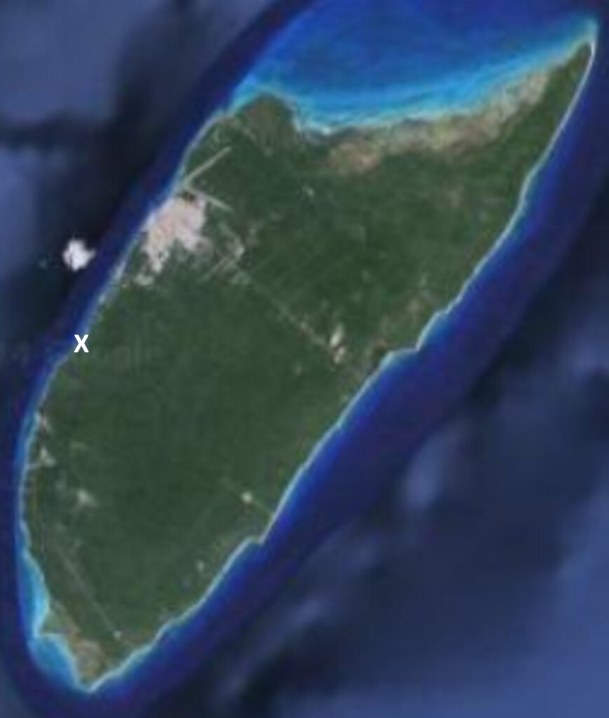
The main opening to Cueva Quebrada is located inside the Chankanaab National Park. There are 3 more openings south of that entrance, in addition to 11 known cenotes throughout the jungle nearby. Cueva Quebrada is one of the most extensive and historically significant underwater cave systems beneath Cozumel. Originally explored and mapped in the 1990s, the system has expanded substantially through continued survey and exploration efforts over the past several decades.
What began as a mapped system of approximately 29,000 feet / 8,839 meters has since grown to exceed 90,000 feet / 27,000 meters of documented passage, placing it among the most substantial underwater cave systems in the region. Cueva Quebrada should reach the 100,000 foot / 30,000 meter milestone within the next year or two.
Geological Context
Like other Cozumel cave systems, Cueva Quebrada formed during periods of lower sea levels when portions of the island’s limestone base were exposed to air. During these dry phases, freshwater dissolution carved passageways while mineral-rich drip water created speleothems – stalactites, stalagmites, and flowstone formations that remain preserved within submerged sections today.
As sea levels rose, the system flooded, transforming dry chambers into fully submerged passageways while preserving evidence of its geological history.
The presence of decorated chambers throughout the system provides clear indication of this transition from air-filled cave to underwater network.
Cave Data
Location: Western shoreline of Cozumel near the Chankanaab area
Geology: Limestone karst formation
Cave Type: Submerged limestone cave
Approximate Depth Range: Approximately 15–70 ft (4.5–21 m)
Water Type: Freshwater lens over saltwater intrusion
Formation Process: Dissolution of limestone bedrock
Primary Access: Coastal cave openings near the Chankanaab shoreline
Additional Access: Cenote openings deep in the jungle
Exploration Status: Ongoing exploration
Structure & Layout
Cueva Quebrada consists of extended horizontal passages, interconnected chambers, and multiple branch systems. Some corridors maintain consistent profile and direction, while others narrow or shift elevation, requiring careful navigation and survey precision.
As the system expanded, additional sections were identified that extended well beyond the original mapped boundaries. Passage continuity and connection potential required repeated verification and systematic documentation.
One of the most significant additions to the system is Sección Escondido (“Hidden Passage”), which alone measures more than 30,000 feet (9,000 meters) in documented length.
Exploration History
Cueva Quebrada was first explored and mapped in the 1990s, establishing approximately 29,000 feet / 8,839 meters of documented passage. Those early efforts provided the initial framework for understanding the system’s structure and scale.
The first major expansion since the original exploration occurred with the identification and connection of the Dos Coronas system. This project added more than 8,000 feet / 2,400 meters of surveyed and mapped passage to the overall network. The confirmed connection marked a significant milestone, demonstrating the potential for further system growth beyond the originally documented boundaries.
The Dos Coronas connection project also initiated a broader effort to reassess and resurvey Cueva Quebrada in its entirety. What began as a focused expansion effort evolved into a long-term mapping initiative aimed at producing an updated and comprehensive survey of the system.
Over the past fifteen years, sustained exploration efforts led by Rob Neto have significantly extended the known boundaries of Cueva Quebrada. Through systematic guideline extension, survey documentation, and repeated verification dives, the mapped length has grown from 29,000 feet / 8,839 meters to more than 90,000 feet / 27,000 meters.
Among the most substantial additions is Sección Escondido (“Hidden Passage”), which alone exceeds 30,000 feet / 9,000 meters in documented length – surpassing the total original mapped extent of the system.
A notable section measuring approximately 5,000 feet / 1,524 meters was discovered by Steve and Judy Ormeroid, two of the original explorers of Cueva Quebrada, further contributing to the system’s expansion.
Fifteen years after the Dos Coronas connection, exploration and survey work remain active, with incremental additions continuing as logistics and conditions permit.
Access to the Hidden Rivers Beneath the Jungle
- Chankanaab shoreline opening
- Dos Coronas 1 shoreline opening
- Dos Coronas 2 shoreline opening
- Dos Coronas 3 shoreline opening
- Cenote S1
- Cenote S2
- Cenote 1km
- Cenote Mayan Road
- Cenote La Roca Boca
- Cenote Abeja
- Cenote Sifa
- Cenote Escondido
- Cenote Catedral
- Cenote Sac Be
- Cenote No Name
Notable Features
- Extensive horizontal passages
- Decorated chambers with preserved speleothems
- Sección Escondido (more than 30,000 feet / 9,000 meters)
- Multiple branch systems extending from original mapped areas
- Ongoing survey and verification efforts
- Multiple cenotes leading into the underground passages
Mapping & Documentation
Survey and mapping efforts in Cueva Quebrada follow established cave documentation protocols, including distance measurement, compass heading, depth recording, and formal map integration.
The growth of the system from 29,000 feet / 8,839 meters to more than 90,000 feet / 27,000 meters reflects sustained, long-term effort rather than singular discovery events. As with all large underwater systems, mapping represents a progressive process rather than a fixed endpoint.
Documented Exploration
Portions of the expansion and connection efforts within Cueva Quebrada are documented in Beneath the Jungle of Cozumel and will be explored further in future installments of the series.
Exploration of caves beneath the jungle of Cozumel continues to reveal more about the island’s underground landscape.
Other Cozumel Cave Systems
Aerolito Cave System
Sin Nombre Cave System
Tres Potrillos Cave System
Cocodrilo Cave System
Chempita (Jade Cenote)
Kuuchi T’uuchtaj Cave System
See also: Map of Cave Systems on Cozumel
Return to Cozumel Cave Systems
Frequently Asked Questions
Where is Cueva Quebrada located?
Cueva Quebrada is located in the Chankanaab region of Cozumel. The main opening is within the boundaries of the national park
How deep is Cueva Quebrada?
Most passages within the cave system occur between approximately 15 and 70 feet (4.5–21 meters).
What makes Cueva Quebrada unique?
Cueva Quebrada is the longest documented cave system on Cozumel. The original exploration in the 1990s included 29,000 ft (8839 m) of surveyed passage. Today, the length of the cave is approaching 100,000 ft (30,480 m).
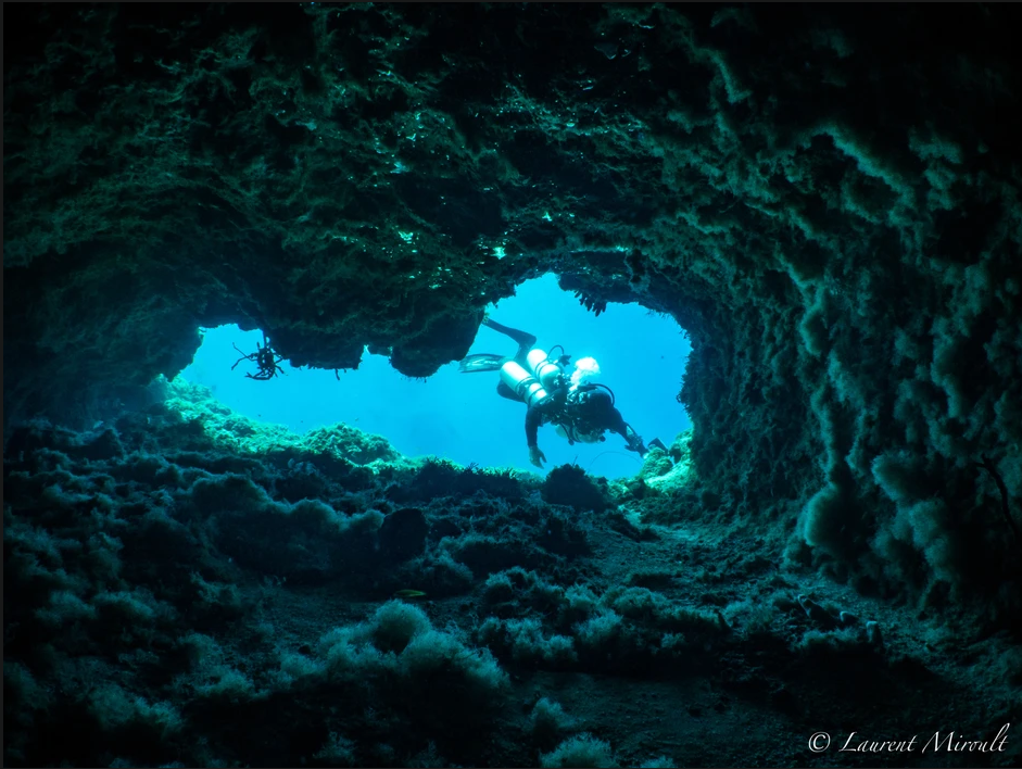
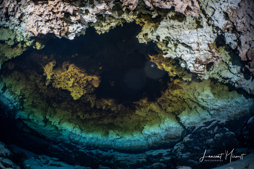
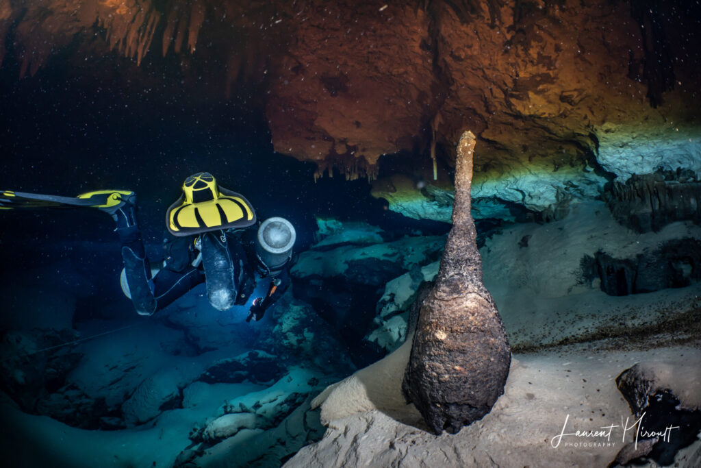
Photo Gallery
The following images were taken in the Dos Coronas section of Cueva Quebrada by Laurent Miroult. These are areas included in Connecting the Crowns.
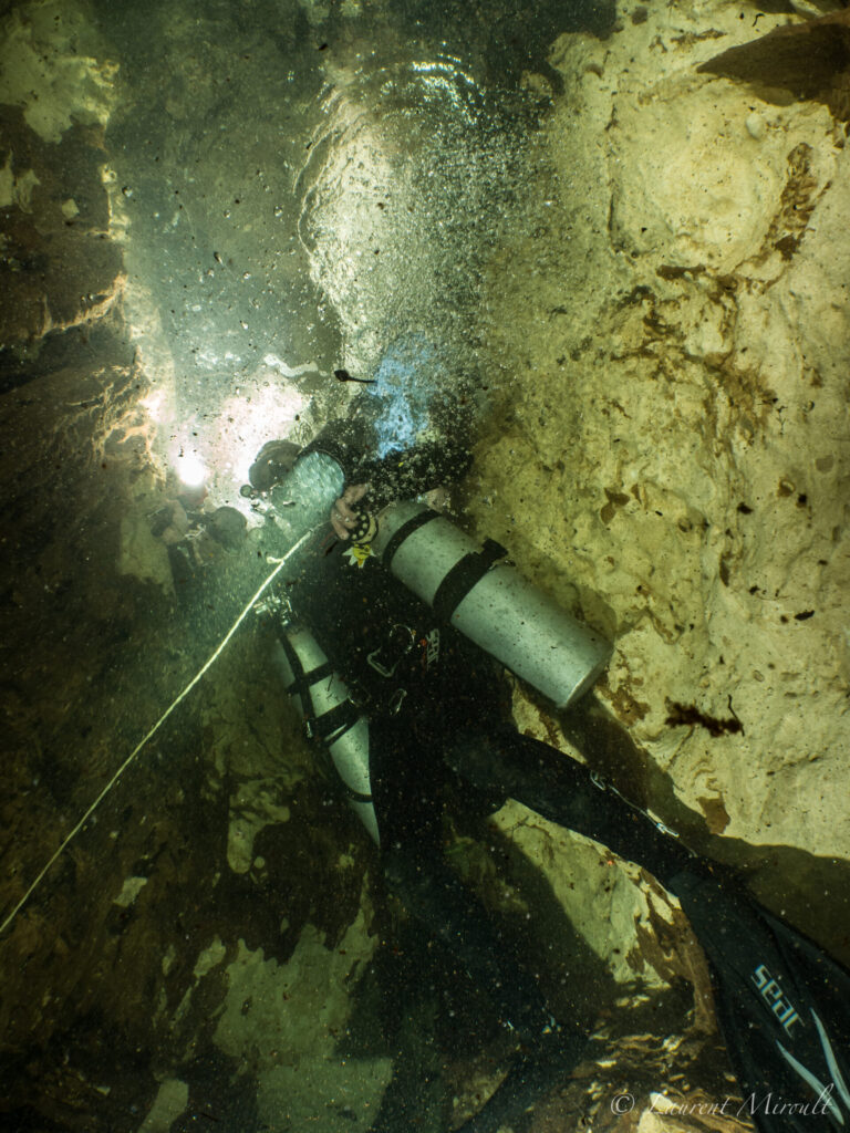
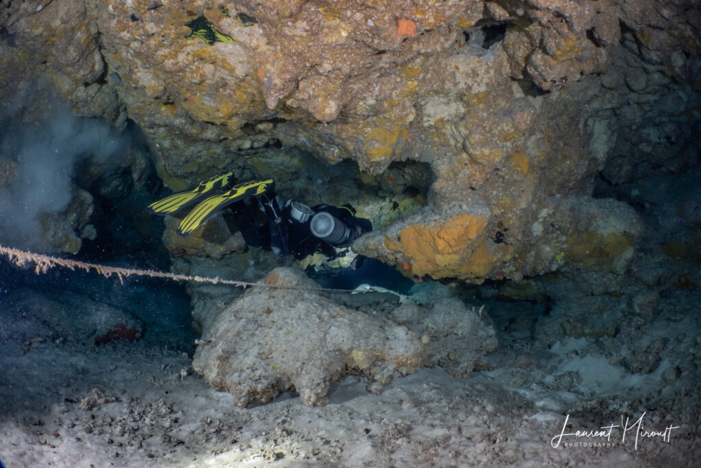
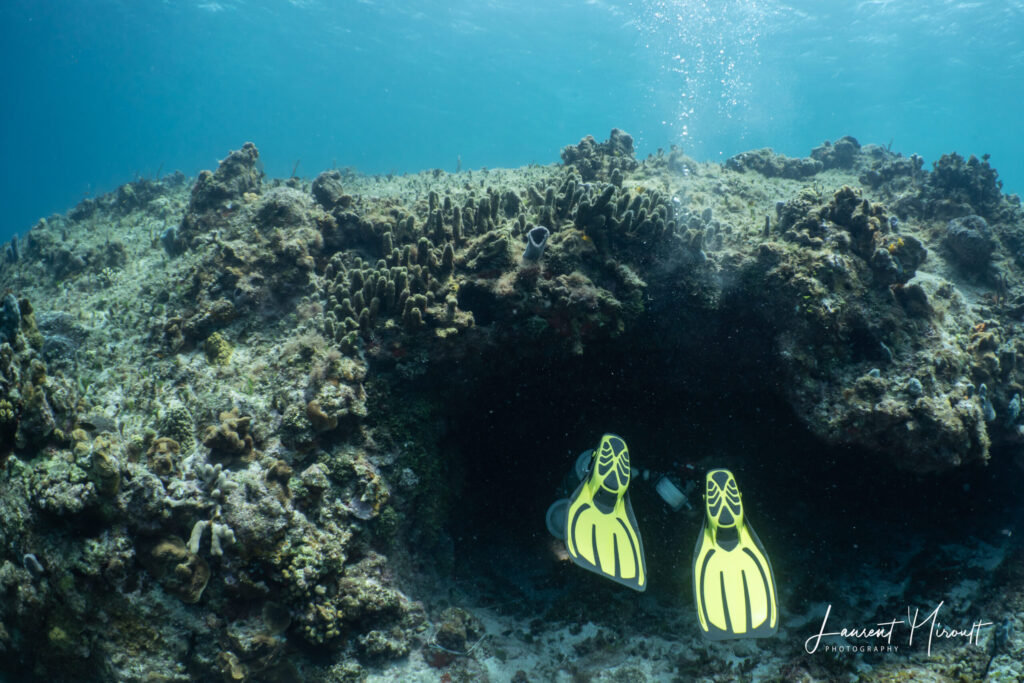
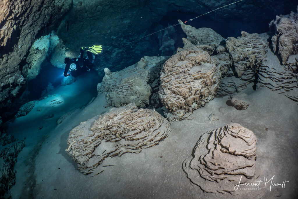
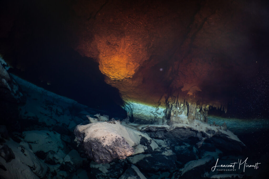
For more photos by Laurent Miroult, please visit cavediving.pictures